
Canadian Transit & Weather Updates – November 10, 2025
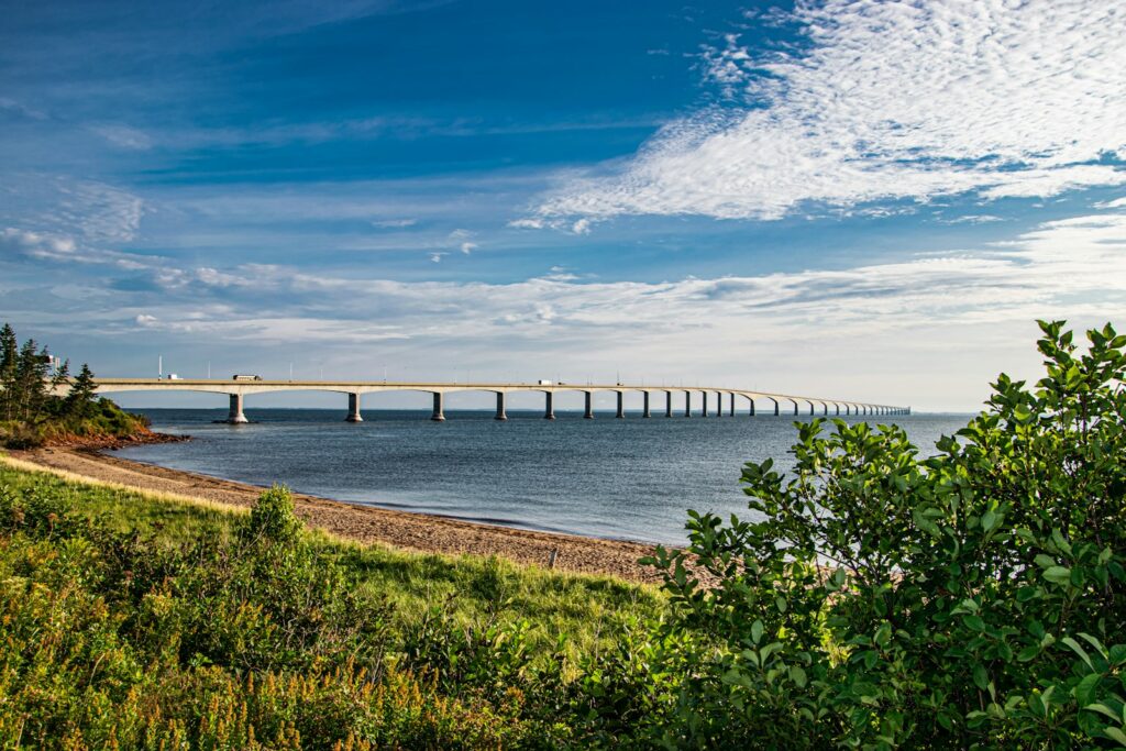
ATLANTIC CANADA SERVICE DISRUPTIONS All ferry crossings to Newfoundland have been cancelled due to weather related conditions for today and tomorrow. As of 10:20 Monday November 10, 2025 – Confederation Bridge is experiencing high winds resulting in restricted vehicle crossings “Restricted classes include automobiles towing trailers, motorcycles, highsided vehicles including trucks, tractor trailers, recreational vehicles, […]
Canadian Transit & Weather Updates – November 7, 2025

ATLANTIC CANADA SERVICE DISRUPTIONS All ferry crossings to Newfoundland have been cancelled due to weather related conditions. Confederation Bridge is experiencing high winds resulting in restricted vehicle crossings “Restricted classes include automobiles towing trailers, motorcycles, highsided vehicles including trucks, tractor trailers, recreational vehicles, and buses.” https://www.confederationbridge.com/
Canadian Transit & Weather Updates – November 4, 2025

Weather Alert for Newfoundland Avalon and Burin Peninsulas may experience 80-110 km/hr winds Tuesday afternoon through Wednesday evening, while the majority of the island will experience 30-50mm of rainfall. Trans-Canada highway between Grand Falls and St. John’s may see possible closure due to weather conditions. Out of town locations (including Clarenville, Marystown, Bay Rovers, […]
CBSA SYSTEM OUTAGE – BORDER DELAYS October 2, 2025
CBSA SYSTEM OUTAGE CAUSING BORDER DELAYS CBSA has been experiencing system outage and issues since Monday September 29, 2025. All ports of entry to Canada have been affected by this resulting in significant delays and backlog. Peace Bridge and Queenston/Lewiston paused commercial truck processing. Windsor has trucks backed up stretching up to 8 km. Although […]
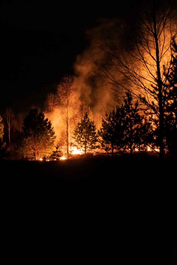
WILDFIRE CLOSURE – AUGUST 11, 2025
***ST. JOHN’S NEWFOUNDLAND TERMINAL UNDER IMMEDIATE EVACUTATION ORDERS*** An emergency evacuation order has been issued for St. John’s Newfoundland terminal due to out of control wildfire creeping in to close vicinity. All inbound and outbound terminal operations will be paused for the safety of terminal employees. All inbound freight will be stopped at the […]
DID YOU KNOW…

CONSTRUCTION HOLIDAY – QUEBEC Did you know there is a 2-week vacation / break for construction related businesses for the province of Quebec? Typically the holiday is the last 2 weeks of July however some years it falls into August (this year is one of them). Many businesses related to renovations or construction close […]
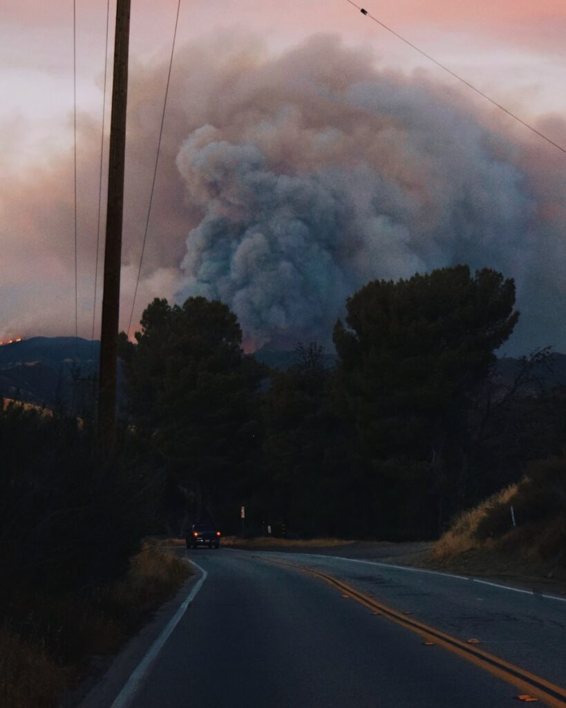
WILDFIRE UPDATE – JULY 25, 2025
***ROAD CLOSURES DUE TO WILDFIRES*** SASKATCHEWAN Wildfire on HWY-916 Both Directions from HWY-2 to HWY-937. All lanes closed. Activities: Fires in area. Visibility: Smoke. Wildfire on HWY-165 at Highway 914. All lanes closed. Activities: Fires in area. Visibility: Smoke. Wildfire on HWY-918 near Fisher Ave. All lanes closed. Activities: Fires in area. Visibility: Smoke. MANITOBA […]
WILDFIRE UPDATE – JULY 16, 2025
***DELAYS EXPECTED DUE TO EVACUATIONS AND / OR ROAD CLOSURES*** ALBERTA Under Evacuation Chipewyan Lake Peerless and Trout Lake Highway 686 between Red Earth Creek and Trout Lake is CLOSED due to wildfire. A detour has been established for LCV carriers operating on Highway 35, which is experiencing closures due to wildfires. During Highway 35 […]
WILDFIRE UPDATE – JULY 14, 2025

***DELAYS EXPECTED DUE TO EVACUATIONS AND / OR ROAD CLOSURES*** MANITOBA EMERGENCY ALERT: Due to rapidly spreading wildfires and extreme fire conditions, Manitoba has declared a Provincial State of Emergency. Multiple wildfires continue to threaten many communities and infrastructure. Evacuation orders and alerts are in effect in northern Manitoba. Air quality continues to be impacted. […]
WILDFIRE – EVACUATION – JULY 10, 2025

***DELAYS EXPECTED DUE TO EVACUATIONS AND / OR ROAD CLOSURES*** MANITOBA Cross Lake, MB – No access – Hwy 373 Closed // Voluntary Medical Evacuation due to smoke Jenpeg, MB – No access – Hwy 373 Closed Leaf Rapids, MB – Mandatory evacuation Lynn Lake, MB – Mandatory evacuation Nopiming Prov. Park – No access […]